|
|
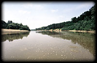 Tisza belongs to the Danube catchment area. 157 thousand km2 in extension, the Tisza catchment area is bordered by the Carpathians in the north-west to south-east, while the dividing is quite low to the west and south-west. The area is divided in the middle by the Transsylvanian island range, to the east of which the
Transsylvanian basin, to the west the the Great plane is situated. In the deep path of the latter runs the middle and lower Tisza roughly following a north-south direction.
|
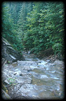 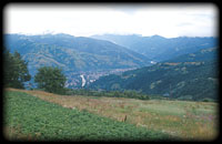 The river has its source in the north-eastern part of the catchment area, in the Máramaros mountains. Irs two branches, the Black Tisza, taking its source in 1680 m elevation in the foot of Szvidovec, and the White Tisza taking its source in 1600 m elevation embraces the 2058 m high peak of Hoverla.
The united Tisza keeps the roughly north-south direction of Black Tisza, as far as the stream in of the left side Visó (Vişeu), which in turn is the first tribitary of significant size. Tisza turns from here west, and after doing a 26 km way takes up Iza, which has its source also in the Radna mountains. Tisza follows the break line
determining the south-east - north-west direction of Iza at the foot of the Avas mountains (M. Oaşului) which makes the precursor of Lápos (M. Ţibleşului) and Gutin (M. Gutîiului) range. Between Avas and the right bank Nagyszőlősi mountains (Vinogradov), in the Huszt gate the water of the river suddenly widens, and before reaching the edge of the Great plain it takes up Tarac (Tereva), Talabor (Tereblja) and Nagyág (Rika) coming from the right bank.
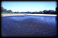 Between Királyháza and the Szamos mouth the river follows an east-western direction. On this section it receives two larger tributaries; Borsát (Borava) from the right and Túr from the left already on Hungarian terrain.
Until the inflow of Szamos the catchment area enlarges to 13173 km2. On the
258 km way doing as far as here its elevation decreases to 103 m, i. e. the decline of the river on its upper course is 1577 m. The upper course of the river, which can be divided hydrologically into upper, middle and lower course, lasts until the Szamos mouth. The border of the middle and lower course is given by the Maros inflow.
|
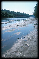 The secound largest tributary of the Tisza is Szamos (Someş). From its 415 km total length only 50 km falls inside the current Hungarian border. The river holds up waters of the northern part of the Transsylvanian basin. One of its two main branches is Nagy-Szamos (Someşul-Mare) accompanying the Radnai mountains to the south, the other is
Kis-Szamos (Someşul-Mic), which originates from the union of Meleg-Szamos (Someşul-Cald), taking its source in the Transsylvanian island range, on the eastern slope of the Bihar mountains (M. Bihorului), and Hideg-Szamos (Someşul-Rece), which springs in
the Gyalu mountains (M. Gilăului). The spring of the Nagy-Szamos is situated in 1558 m elevation, while Meleg-Szamos starts in 1358 m, Hideg-Szamos in 1683 m elevation. Until the union the length of Nagy-Szamos is 119.6 km, the expansion of its catchment
area is 5034 km2. Its main tributary is Sajó (Şieu), and Beszterce (Bistriţa) flowing into the Sajó. Kis-Szamos collects the water of a 3804km2area. Its tributary is Füzes (Fizeş) flowing in near the union with Nagy-Szamos. United Szamos has two larger tributaries. One of them is Almás (Almaş), the other is
Lápos (Lăpuş), which takes its source in Lápos and Gutin mountains. The total catchment area of Szamos is 15882km2, which hence is larger then that of the receiving Tisza. Therefore it is conspicuous, that the water output of the Szamos is 134 m3/s by the average of many years, while at its inflow Tisza brings 203 m3/s water. The reason of this is, that the catchment area of the
Szamos, in consequence of being enclosed by high mountains, is much shorter of precipitation, than the spring region of the Tisza. The mean descent of the bed is 16 m/km on the mountain course, 0.64 m/km on the Romanian lowland course, while about 0.22 m/km on the Hungarian lowland course. The secound largest tributary of the Tisza is Szamos (Someş). From its 415 km total length only 50 km falls inside the current Hungarian border. The river holds up waters of the northern part of the Transsylvanian basin. One of its two main branches is Nagy-Szamos (Someşul-Mare) accompanying the Radnai mountains to the south, the other is
Kis-Szamos (Someşul-Mic), which originates from the union of Meleg-Szamos (Someşul-Cald), taking its source in the Transsylvanian island range, on the eastern slope of the Bihar mountains (M. Bihorului), and Hideg-Szamos (Someşul-Rece), which springs in
the Gyalu mountains (M. Gilăului). The spring of the Nagy-Szamos is situated in 1558 m elevation, while Meleg-Szamos starts in 1358 m, Hideg-Szamos in 1683 m elevation. Until the union the length of Nagy-Szamos is 119.6 km, the expansion of its catchment
area is 5034 km2. Its main tributary is Sajó (Şieu), and Beszterce (Bistriţa) flowing into the Sajó. Kis-Szamos collects the water of a 3804km2area. Its tributary is Füzes (Fizeş) flowing in near the union with Nagy-Szamos. United Szamos has two larger tributaries. One of them is Almás (Almaş), the other is
Lápos (Lăpuş), which takes its source in Lápos and Gutin mountains. The total catchment area of Szamos is 15882km2, which hence is larger then that of the receiving Tisza. Therefore it is conspicuous, that the water output of the Szamos is 134 m3/s by the average of many years, while at its inflow Tisza brings 203 m3/s water. The reason of this is, that the catchment area of the
Szamos, in consequence of being enclosed by high mountains, is much shorter of precipitation, than the spring region of the Tisza. The mean descent of the bed is 16 m/km on the mountain course, 0.64 m/km on the Romanian lowland course, while about 0.22 m/km on the Hungarian lowland course.
|
 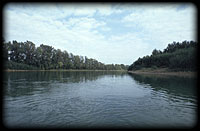 Kraszna, feeding the former Ecsed moor, was flowing into the Szamos until the 1890's. Its lower course has been removed in such way, that now it flows directly into the Tisza about 3.5 km below the Szamos mouth. From the Kraszna mouth Tisza turns north, going round the barely 170 m high Nyírség sand ridge, and it reaches its northernmost
point at Záhony. Here it takes its route west-south-west with a sharp bend, it takes up Lónya main channel from the left, which collects the Nyírség waters, and in the foot of the Tokaj Kopasz hill, 544 km from its mouth it takes up its most important
right bank tributary Bodrogot.
|
|
Showing the Tisza and its catchment area the most important artificial stream of the Great plane water network,
Eastern main channel should be mentioned,
which branches out from the Tisza at Tiszalök.
|
|
The flow of the Tisza is directrd south-westwards from the inflow of Bodrog. It follows the Taktaköz sinking, and on the south edge of that it takes up Sajó, increased by Hernád, also from the right. Waters of the Bükk mountains get into the Tisza through an old Tisza bed, the Small Tisza.
|
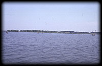 By damming up the section between Kisköre and Tiszavalk (441.0-403.2 river kilometres)
Tisza Lake has been made within the foreshore of the Tisza, which with its 127 km2 extension has become the secound largest stagnant water of the Carpathian basin. Damming was enabled by putting the Kisköre barrage into operation in 1973. The aim of the investment was the complex ecogeographical reconstruction of the mid Tisza valley, the improvement of natural an d social relationships.
|
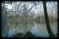 The next tributary of the Tisza is Zagyva, the main drain of waters of Mátra and Cserhát mounts, coming also from the right bank. After the Zagyva mouth the river turns south, and keeps this direction parallel to the Danube even until the mouth. It is accompanied by the sand ridge between the Danube and the Tisza to the west, from
where it does not get any significant water. However, the next left side tributary Triple Körös is quite important, the catchment of which is the escound largest (27537 km2) among the tributaries. Its network consists of five rivers spreading like a fan: Fehér- (White), Fekete- (Black), Sebes- (Rapid) Körös, and Berettyó and Hortobágy-Berettyó, the first four of which are fed by waters of the Transsylvanian island range, while the last one drains waters of the plains beyond the Tisza.
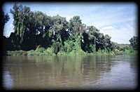 The most important water last flowing into the Tisza on the territory of Hungary is Maros, which catches the waters of the southern part of the Transsylvanian basin from a 30332 km2 area. At the esction below the Maros the western edge of the dividing approaches the Danube at Baja. On this section Tisza takes up only two
rivers, which tekr their source in Romania, but both of which reach the Tisza in Yugoslavia. These are Aranka of lowland character, and Béga, flowing 9.6 km from the Danube mouth. Finally Tisza reaches its recipient, the Danube at Titel on the territory of the present Yugoslavia.
|
Stagnant waters accompanying the Tisza
|
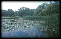 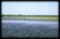 Number of dead beds by the Tisza is 149 in Hungary, their total surface is almost 3000 ha. These freshwater habitats as refugees play an important role in sustaining the aquatic or water linked plant and animal life of the Tisza valley becoming dryer. Their valuable vegetation and
fauna makes them especially important from the viewpoint of nature conservation. Most important among them are mortlakes of so called "temple" character, which are under the protection of nature conservation. On the upper Tisza such a place is the Helmecszeg Dead Tisza (Tarpa), or the Boroszlókert Dead Tisza (Gulács), the Herep Dead Tisza (Tiszacsege), or the Mártély Dead Tisza (Hódmezővásárhely). Their utilization
aims mostly recreation or fishing - Nagy-morotva, (Big mortlake at Rakamaz), Vargaszeg Dead TIsza (Tarpa), Marótzug Dead Tisza (Gávavencsellő), Tunyogmatolcs Dead Tisza
  (Tunyogmatolcs) - and they also serve as water supplies for agriculture or industry, e. g. Alcsisziget Dead Tisza (Szolnok). (Tunyogmatolcs) - and they also serve as water supplies for agriculture or industry, e. g. Alcsisziget Dead Tisza (Szolnok).
|
 Among fish ponds the most important are the Hortobágy fishlakes, the total surface of which is almost 6000 ha, and the one near Szeged, the most noteble member of which is the Szeged Fehér tó (White Lake) - and the Biharugra fishlakes vith an also more thousand hectares extension. Among water reservoirs on the whole length of the Tisza with its size the most striking is the above mentioned Tisza Lake, the extension of which is 127 km2, but we should mention the Szabolcsveresmart reservoir on
the upper Tisza, flood protection reservoirs (of Kunkápolnás and Füredkócs) on the mid course on the Hortobágy, which has been formed from the old beds of the Tisza - now serving nature conservation purposes as well, or the two reservoirs of irigation purpose along the Eastern main channel. There are mortlakes and reservoirs of
different purposes in large number on the lowland areas of the river disannexed from Hungary, on the Southern region, on the Highland region, in the Mezőség and within the Transsylvanian basin too. The most important of these are Záh lake (Lacul Zau) in Mezőség, Cege lake (Ţaga Mare) on the Füzes brook, the Ungszenna (Senné) lakes on the
Highlands, and Palics lake near Szabadka (Subotica) and the Melence (Melenci) Ruszand lake. Fish ponds of significant extension have been made in Romania and Slovakia too.
|
|
On the mountain course on the Slovakian part more dam lakes and 35 smaller natural stagnant waters can be found. The most important among these are Vihorlát reservoir (Zemplínska írava) made for the repression of flood peaks of Laborc with its 3000 ha extension, and Ondava Nagydomása reservoir (Vežka Domaa) with 1400 ha. In addition
to the lakes of Mezőség on Romanian territories mentioned above, mountain lakes originated from glacial hollows of Radna, Szeben and Szörény mountains, and lakes of the south Transsylvanian salt basin are worthy of mention. The major part of these does not rich even a 1 ha extension.
|
Geographic features of the Tisza catchment area
|
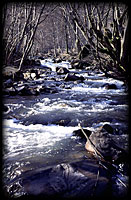 On the spring region of the Tisza in its vallies of 20-50 m/km decline we can hardly speak about a bed. After larger rainfalls flood runs through the valley bottom on its whole width, while in dry weather water gurgles only on the stairs made by the rocky bottom and hides between huge rock-glaciers. Below the union of the Black and the White Tisza we can speak about
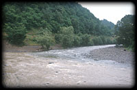 a wild mountain brook abounding in water, which already has a shallow bed. The stoney bed is succeeded by the large size gravel. From the inflow of the Visó the original water output doubles, and at the same time the decline of the bed decreases to 2 m/km. Here the bed is a few decimetres deep, with gravelly bottom, the river meanders among islands and gravel shoals, continuously changing its rout. Below the influx of Borsa the decline of the bed further decreases, and together with this the gravelly bed material changes about the size of hazelnuts, and waters flowing between wide gravel shelfs, divided in branches up to this point, continue their way in a capriciously winding, but united bed. The river reaching to the Great plain runs in a deep bed.
Its decline decreases quickly, in the hight of the Szamos mouth it shows a value around 8.8 cm/km and vetween Kisköre and the mouth it decreases from 3,7 cm/km to 2,5 cm/km. The river bed coming into the country is small grained gravel and which changes till the Szamos mouth into fine grained sand.
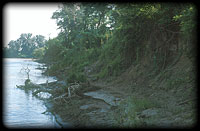 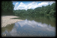 Mud and clay appears and becomes higher and higher in proportion from the mouth of Bodrog towards the lower course. On the Tisza lowland the river bed changes more or less around 200 m wide, however in certain sections it is only half of that or even less (at Szolnok: 95 m), while elsewhere it becomes 300 m or at Zemplénagérd 420 m
wide. It should be mentioned here, that flood protetcion embankments on the lowland course are 1400-1800 m wide in average, but in many places they are less than the half of the average, so in the region of Martfű they are only 205 m wide. Winding is a
characteristic feature of the lowland course. A nice example of meandering can be seen on the upper course, where till the mouth of Borsa original conditions can be seen, while below that due to the bed froming ability of the river, it made extremely numerous windings since the control works. Below Dombrád this sight changes, because
the material of the valley becomes more resistant and the decline of the river decreases. Flat curves of wider arch are characteristic to this course.
|
|
Among natural froces shaping the water regime of the Tisza temperature and precipitation relations and outflow characteristics are basic. The Tisza catchment area has a temperate continental climate. This general image is modified by meso- and micriclimatic factors, such as modifying effect of the relief, exposition and vegetation of the given place.
|
 In general mean annual temperature is 10-11 °C on the lowland parts of the Tisza catchment area, while 8-9 °C within the Transsylvanian basin, and 6-9 °C on middle elevation mountains. Averages of many years, however do not reflect the real face of the climate of the catchment area. Mean annual temperature values themself show a 3-4 degrees of fluctuatuon, but differences are significantly greater considering certain months, which can exceed 10 degrees differences as well. Of course the largest differences are from the temperature extremities. Thus the greatest value of the fluctuation of the temperature is 70 degrees (max. 41.3 °C; min. -32.2 °C), which proves the continental character of the climate.
|
 The Tisza catchment area is poor in precipitation. About 60% of the upper river gets more than 1000 mm precioitation annually. The valley of the Black Tisza is in the shadow of the Hoverla, and the annual precipitation does not exceed 1200-1300 mm at the spring region of the White Tisza. Compared to their high elevation the valleys of Visó and Iza are definitely dry. West of the Huszt (Khust) gate, coming out to the Great plane, the river gets a rapidly decreasing amount of precipitation, and this stays below 600 mm per year everywhere on the Tisza lowland.
|
|
The catchment area of the Szamos is essentially poorer in precipitation than that of the Upper Tisza. The Spring region is on a place definitely sheltered from the rain mainly thanks to the east-western direction of the Radna mountains, which is the spring region of the Greater Szamos, and the Bihar mountains, which is that of the Lesser Szamos. At the junction of the two river branches, in the heart of the Transsylvanian basin, the amount of the mean annual precioitation does not exceed 600 mm. On the further route of the river from the direction of the Gutin a region, more rich in rains, links to the catchment, which is characterized by 1263 mm of Kapnikbánya (Cavnic) and 953 mm of Nagybánya (Baia Mare).
|
 Distribution of the precipitation within a year is worthy of attention. Since on the whole catchment area temperate continental climate is a dominating factor, early summer precipitation maximum is characteristic. About 25 % of the annual precipitation falls in May and June. This image is modified by the air currents of the Mediterranean Sea, in consequence of which the summer precipitation maximum is being completed with a secoundary autumn maximum around October-November. Annual distribution of precipitation therefore is quite uneven; it can be characterized by two peaks and a dry season between them. Distribution of precioitation of the mountain courses is greatly influenced by the relief, here it is more balanced to a certain extent. Significant differences show also in distribution of precipitation of certain years, which is not only the characteristic feature of the last decades in this region.
|
 The other important element of the water regime is evaporation. Relative humidity on the Tisza catchment area is 80-85 % in the winter months, and 60-65 % in summer. On the Great plane in the summer months - primarily around noon - humidity decreases
even on 40 %. From a hydrological point of view evaporizing capacity of the atmosphere is very important, which shows the potential maximum of evaporation. The real value of evaporation stays below the possible values on the lowland areas poorer in precipitation, but in part within the Transsylvanian basin too, the reason of which is, that evaporation exhausts water reservoir of the soil. Assuming the relationship of
the potential evaporizing capacity and precipitation the received image well represents the arid character of the Tisza catchment area. According to these annual evaporation on the Great plane exceeds annual precipitation even in mean annual
amounts, namely on significant part of the territories beyond the Tisza in a measure exceedind 40 %. Total water deficit of the vegetation period (April to September) on the Great plain reaches 160-180 mm.
|
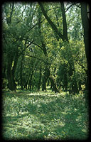
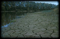 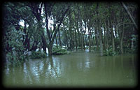 Outlining the geographic image of the Tisza catchment area it can be sayd, that the water libration value on the Tisza is quite great, tends to extremities. Beside natural forces this is further strengthened by human influance. Averages of the low level water output between the influx of Szamos and the mouth stay much below 100 m3/s, they can decrease even to a value of 40 m3/s, whlie flood
level water output varies around 4000 m3/s. There are significant differences between water outputs of certain years too. By the evidence of the annual data 10-15 year long wet and dry periods follow each other in the Tisza valley. Water outputs within a year follow the characteristics of the climate.
 In general on the territory of the catchment area spring months are the most abundant in water. Floods are quite violent, their drainage is significantly influenced by floods of tributaries. During long lasting rainy periods floods can be congested. It is a peculiarity, that ice-floes are of much less significance on the Tisza, than on
the Danube, because in the deep bed piling ice cannot rise water level significantly. Because Tisza is a river of definitely lowland character - the proportion of mountain areas on its cathment area is about 1 %, while those below 200 m is 46 % - and the highest point of the chatchment area (2506 m) is below the permanent snow-line, it is
lacking in glacier waters and moraine lakes, which could provide continuous water supply. The amount of outflow is influenced by impermeability of the catchment area too. From this point of view it can be stated, that semipermeable surfaces dominating in the catchment area of the Upper Tisza, the Szamos and the Bodrog are able to moderate violence of floods, and they serve as some reserves in the low water
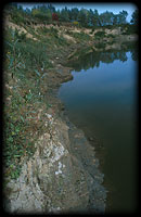 periods. There is an impermeable surface on the Great plain, and the same thing is characteristic to the Körös region. On these territories this is the main reason of inland waters. After draining the water stored in the snow cover water output
decreases rapidly, i. e. water reserves of the river exhaust soon. Low water period appears primarily in summer and in the autumn, mainly between August and October, which state, besides shortage of precipitation, is further worsened by high value of
evaporation. Highest low water values have been measured in the last years, due to the deepening of the bed following river control works. Extremities of water libration everywhere reach 8 m, but in extreme cases in some sections water libration reaches 20 m.
|