|
|
|

|

|
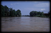
Tisza. There is no one other river, which sometimes by its majestic loop, sometimes with its unmanageable run would be engraved itself so deep into the heart of the Hungarian people. The proverb says: "Who drinks the water of the Tisza, longs to be back there." This can be true, because the unique feeling of the river has touched the soul of Sándor Petőfi and Gyula Juhász, two of our great poets, but the beauty of the blond Tisza, its ribbon, accompanied by tide forests, the mysterious inhabitants of its mortlakes has been preserved in many songs and tales by the people living here too. It is sayd, the Tisza is mild and capricious like a woman, so one must not treat it else: it should be loved, but it should be protected as well, so that its water could refresh who come after us, its fishes could nourish our grandchildren, and so that their soul could find home in the peaceful Tisza scene.
In order to understand the river indeed, it is indispensable to get acquainted with its evolution, development, environment and its relations to man. We have an opportunity for this on the following pages.
What you can find here:
The beginning of the formation of the Tisza water regime in a narrow sense falls on the end of the tertiary, about 1,5 million years ago. In the pliocene epoch due to the rise of massifs in more phases, a close basin has been formed in the territory of Hungary, the Pannonian sea, which at the end of the epoch has been gradually silted up. That time waters from the north and north-eastern Carpathians headed for the deepest point of the Pannonian basin on the line of the recent Ér and Berettyó, and through the medium of the Ancient Maros valley, waters of the Transsylvanian basin and the Bihar mountains have flown here too. In the pleistocene epoch formation of the Tisza bed has been determined mainly by local tectonic changes. An important phase is the moderate sinking of the Bodrogköz-Szatmás plane and the stronger rise of Nyírség, is the consequence of which the river left the Ér-Berettyó-Körös route, its path has pushed northwards, and was forced to a north-western bend at the north edge of the Great plane (Alföld). Its further route at the borders of Hortobágy-Kunság and Borsod-Heves-Jazygia (-Jászság) has been marked out also by sinks. During these changes in the bed Tisza has crossed its right bank tributaries and has broken up into more branches. Its water has flown on partly in the old bad of its tributaries, partly in the new bed marked out by the sinks. From the reach south from Tokaj many branches lead in the left old beds towards the Sárrét depression.
The evolution of the Tisza
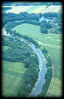 The Tisza catchment area, the path of the rivers has been formed and shaped to the recent form by external and internal surface forming factors, i. e. on one hand tectonical movements and volcanic activity, on the other hand water and wind.
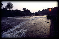 Recent water regime of Tisza, which has not already beared marks of human influence, presumably has formed as follows. The river, arriving to the plain, has turned north at the Szamos outlet, later after making a 50-60 km route, at Záhony it has changed direction again, it has continued its way west-south-westwards, it has passed round Tokaj hill and around Tiszaluc, along the alluvial cones of Sajó and Hernád it has turned southwards. Lower down it has meandered at the Heves plane, and around Csongrád it has turned south again. On this section according to the lower reaches of the right bank tributaries and changes of local sinkings, more smaller branches have broken out from its body. Branches braking out below the Tokaj gate have reached the Körös basin through the Hortobágy, Berettyó, Zádor, Kakat, Mirhó, Büdös-ér and Nagy-Hék. Right side tributaries has shown a similar sight, they have also breaked into more branches feeding more streams. These covered the whole territory with a network. That time both right and left side tributaries had a greater water output, i. e. large number of streams abunding in water was characteristic to the region.
 Reaching the Great plain, losing its relief energy in a very short time Tisza is forced to deposit its slit, creating series of alluvial cones. Recently the Hungarian part of the river's catchment area is divided by three major alluvial cones into five
parts. The alluvial cone of the Nyírség is being enclosed between the upper Tisza bed (Kraszna, Szamos, Túr) and the water regime of Körös-Berettyó. The Bükk hillfoot alluvial cone divides the valleys of Sajó-Bódva-Hernád from the waters of the Zagyva-Tarna. Finally the Maros alluvial cone separates the Maros valley from the Körös catchment area. Further consequence of the gentle slope is, that the river runs
towards its erosion base with large roundabouts, curves. Coming out to the Great plane, Tisza is a meandering river of middle course character. Its route is accompanied by cut windings, i. e. mortlakes, belt-shallows created by floods. So there are
continuous changes in the geological present too. The bed is continuously changing by wandering and cuttong windings.
Recent changes, human influence
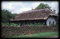
 Earliest traces of human influence are from the copper age. A more significant transformation of the landscape appears from the 5th century A. D., the remains of which are drainage-protective ditches, trenches and mounds, and the also
multifunctional fishgarths. People of that age, by strengthening natural resources applied tide lands to their own use probably with a considerablely favourable efficiency, i. e. they produced their goods with low cost, without decreasing natural
resources. They linked left beds on tide lands with semistatic or ephemerous waters, creating a unified water regime. Annual floods provided the base of agriculture. Floods inundated lower elevation areas through cuttings made on natural high banks accompanying the river, and the flood went back to the parent bed through these cuts.
Since flood happened from below, the major part of alluvial deposits was set down even at the cuttings, which were maintained by regular dredging. Therefore water management was made not by quick drainage of the flood, but by regulated spreading of it. Utilization was wide range, including fishing, animal husbandry, agriculture and fruit growing too. This complex utilization system is called tide
land, or cutting farming. It should be emphasized, that the character of tide land farming basically differs from the present day method, considering that it was based not on using up natural resources, much rather on strengthening them. Its other important feature is, that in tide land farming tilling of arable land was only to a smaller extent, acting a subsidary role. In the course of tide land utilizations
melioration works considerablely transformed the original, ancient physiognomy of the landscape, actually since that time the character of the tide land was decisively determided by human influence. Tide land farming went into a decline in the 15-16th century, the first moments of which were the clogging of cuttings and ditches. We can speak about the large scale swamping of the Tisza valley only since that time.
Probably the most important reasons of relatively quick changes beside demographic sides were large scale decrease of the proportion of tide forests (both at the spring region and on the plane), and increasing number of artificial dams due to the appearance of watermills.
Large scale meliorations, the result of which determine the hydrogeographic image of the Tisza valles even till toway, have started in the middle of the 19th century.
 Control works aimed primarily building of flood-prevention embankments and cutting out windings in order to drain floods as soon as possible. Works have been started with the management of Széchenyi, using the plans of Vásárhelyi, more correctly in the first part of the century mainly using those of Mátyás Huszár. It must be noticed, that that time more experts were of the opinion, that tides of the
river are not necessary to prevent, only to limit, or rather they insisted on creating a control system based on spreadig over the floods. The starting point of the large scale landscape transforming work was marked by the foundation of the Tiszavölgyi Company in 1846. The first cut has been made in the region of Tiszadob in 27. August 1846. All subsequent phases of the river control can be linked to larger floods.
Besides the Tisza the control of its tributaries has also begun. Definitive work has been made on the Szamos only after 1890. During the control works 36 windings have been cut through, and with a 1300 m short cut a new mouth of more favourable direction has been shaped, about 2,5 km below the old one. In consequence of the water
management of that time drying of the Great plane has started, and the appearing of inland waters has called that irrigation and inland water drainage channel network into being, the works of which has started in the 1930's, and finished about in the 1950's, but the maintenance and developement of which lasts continuously today.
©
1996-2001 TERRA Foundation for Environment Protection and Education
Last update: Webmaster, 24th Oktober, 2001